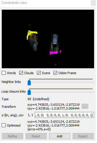
Hello,
I have seen this request asked about before, and I agree with the response that it would be best to get high quality depth images to close the loops automatically. However, I have a few data sets in which I would like to close loops in a part of the map that I cannot physically pass through (i.e. tall spaces with no means to traverse directly from bottom to top).
In the attached example it seems like there should be enough geometric information in regenerated laser scans to get a reasonable ICP registration of these two poses after a link is added. Note that I would have to increase the maximum distance when regenerating laser scans relative to the settings in my example screenshot. Or, if there was a way to set control points in the two depth images, a rough alignment could be done.
I believe the problem in this case is that I am viewing the feature in these poses from a ~150degree different perspective so it is difficult to get matching features. Even if I set MinInliers and MaxFeatures to 0, I cannot add a link in the RTABMap Database Viewer.
Is there a way to edit or add links in a SQL database editor? I have tried using SQLiteStudio, and I can see the data for from_id and to_id but the transform (which I assume should be a quarternion) is not displaying correctly.
Another option would be to get some rope and lower the sensor down to close the loop. But it would be nice if I knew how to rescue less-than-ideal data.
Thanks,
Alan

