CATKIN_MAKE error while cloning rtabmap_ros package.
12
12
|
Administrator
|
Hi,
To add lidar, look at those examples: http://wiki.ros.org/rtabmap_ros/Tutorials/SetupOnYourRobot When using rtabmap, you don't need map_saver ot map_server. rtabmap can be launched in localization mode, it will publish it self the occupancy grid and localize on it. For navigation, you should try to send goals using 2D nav goal button in rviz. More doc here: http://wiki.ros.org/navigation/Tutorials/Using%20rviz%20with%20the%20Navigation%20Stack cheers, Mathieu |
|
In reply to this post by karishma
Good Morning Sir,
Hope you are doing great. I need to get 3D point clouds ( preferaabaly in .xyz format sir to export them onto Autodesk Recap etc for further processing). From the saved rosbag file of the 3d pointcloud I have taken, I am able to get .pcd file. But when I view it with pcl_viewer, it is looks like just the outline of the area in "dots", instead of the actual picture. Is there any way to get the entire pointcloud like in the second picture I am attaching onto this message sir? These are commands, that I ran to capture the Pointcloud message (sensor_msg/Pointcloud2) published by the topics 1. rosbag play rtabmap1.bag && 2. roslaunch rtabmap_ros demo_robot_mapping.launch rviz:=true rtabmapviz:=false && 3. rosrun pcl_ros bag_to_pcd rtabmap1.bag /rtabmap/mapData ./Downloads First image: kinect+rtabmap_ros+rosbag (.pcd) Second image: a pointcloud cloud capturing application from an Ipad. (.xyz) 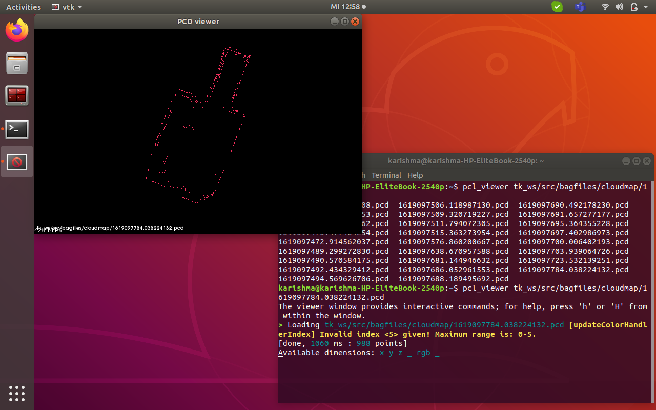 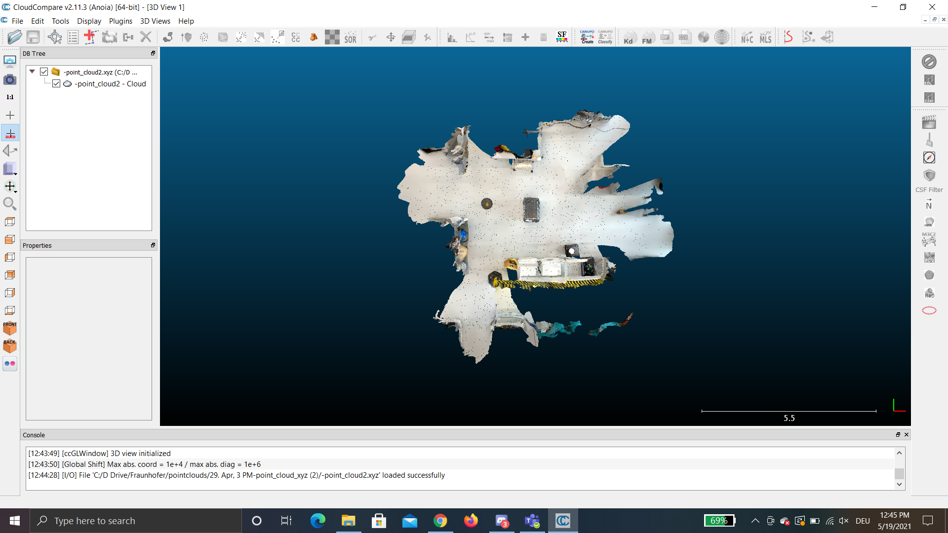 Best regards, Karishma. |
|
In reply to this post by matlabbe
Good morning Sir,
Hope you are doing good. A gentle reminder Sir. Sorry for bothering you sir. May i ask, if you have had the time to look into my issue. 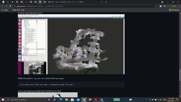 In addition to the questions in the previous message (June 7th) , I would like to ask about one more thing Sir. I have come across a camera named, Realsense D435i, which kind of gives the result as the picture attached in this message. My question is, can I get the similar output as Realsense D435i from the kinect + turtlebot2 + rtabmap_ros that I am using currently sir. Can we use a realsense R200 or D435i for the autonomous navigation with rtabmap_ros and obtaining a pointcloud sir? Best regards, Karishma. |
|
In reply to this post by matlabbe
Good afternoon Sir,
I am really sorry bothering you, sir. But I have only you to go for help, sir. Kindly please excuse sir. I have a rosbag file which is saved version of the 3d mapping with the rtabmap_ros. I could visualise the pointcloud on RVIZ and RTABVIZ, but I am not sure how to save this pointcloud as a whole and be able to view and export it on to cloudcompare or meshlab applications. A. On RTABMAPVIZ (does not work for me) " The option in RTABMAPVIZ with File->Export 3D Cloud" doesnot work for me, because all are options in file, edit are totally disabled. I tried your instructions as given in this https://github.com/introlab/rtabmap_ros/issues/215 ""To save the cloud, I suggest to open the database afterward with rtabmap standalone app ($ rtabmap ~/.ros/rtabmap.db), then do "File->Export 3D clouds...", you will have many options to export the point cloud (PLY or PCD, or even OBJ if meshing is enabled). If you don't care about cloud density, /rtabmap/cloud_map topic can be a good choice too, which is a PointCloud2 topic that can be easily save to a PCD using pcl_ros."" and https://github.com/introlab/rtabmap/wiki/Kinect-mapping#export 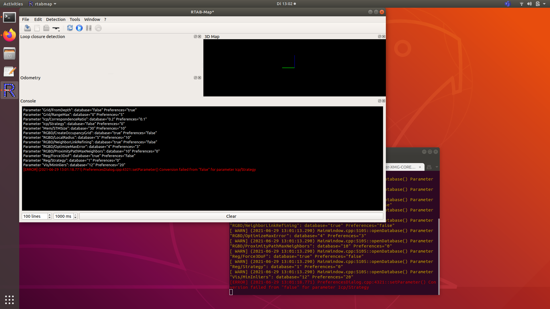 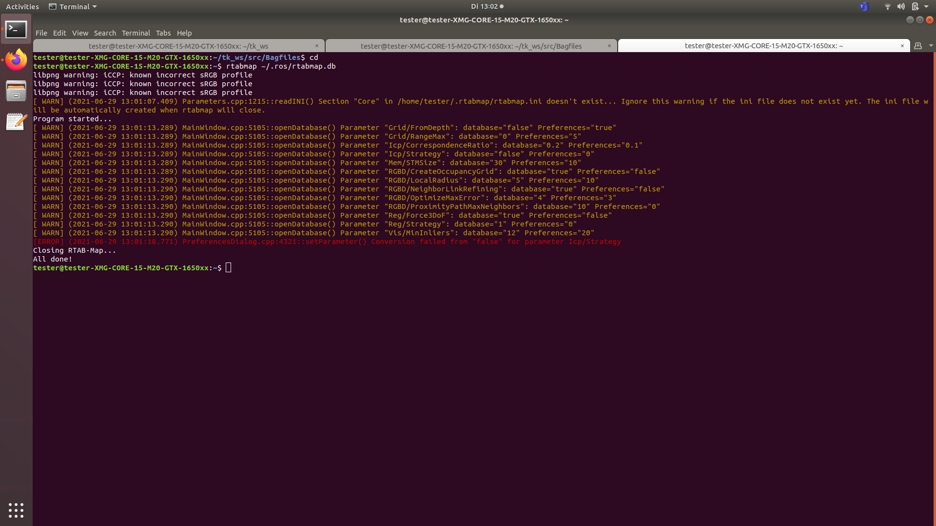 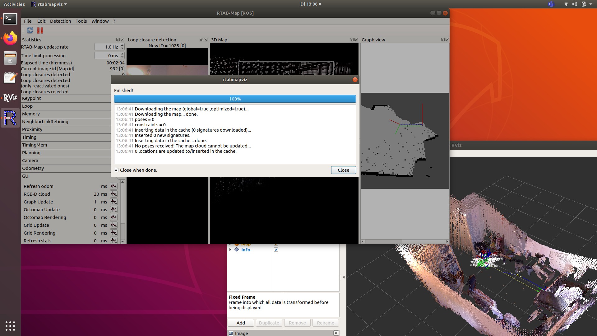 It is not working to at all sir, export option, download all clouds option sir. And B. On terminal (also does not work) rosrun pcl_ros pointcloud_to_pcd input:=/rtabmap/cloud_map and changing the boolean value to true All i could get are a red dotted outline on the ground view. I need the actual 3d projection of the pointcloud so that I can be able to export and import it on meshlab/cloudcompare/autodeskrecap sir. 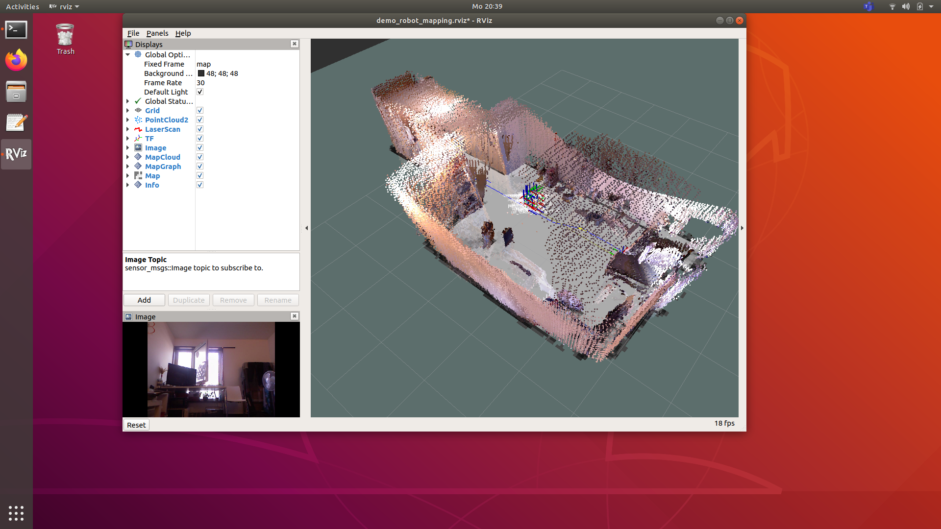 Kindly please help me out. I am on the verge of completing my project. This is one last thing to be done. Thank you very much sir, Karishma. |
|
Administrator
|
Hi,
Not sure I followed correctly everything, but it seems in the first posts you are recording 2D scans, so a 2D point cloud is generated from the /rtabmap/cloud_map topic. If you want the 3D cloud from the RGB-D camera, add Grid/FromDepth to true, then /rtabmap/cloud_map will be 3D. However, not sure it didn't work for you, but the easiest way is always to open your database with rtabmap or rtabmap-databaseViewer and use File->Export 3D clouds. You can choose from rgb-d data (default) or scan data. For the Icp/Strategy error, it should be a warning in latest versions. IF you are just exporting data, you can ignore the error. cheers, Mathieu |
|
Hai Sir,
Thank you very much for your response. I have a doubt sir. 1. should the "Grid/FromDepth to true", be done to this demo_turtlebot_mapping.launch launch file when taking the scans ? Because I have tried, i have changed "Grid/FromDepth to true" in the "demo_robot_mapping.launch" file sir. And when the rtabmapviz is opening, it shows nothing sir. My steps: Terminal 1: $ roslaunch rtabmap_ros demo_turtlebot_mapping.launch args:=“- - delete_db_on_start” Terminal 2: $ roslaunch rtabmap_ros demo_turtlebot_rviz.launch Terminal 3: $ rosbag record -a -o rtabmap.bag --Ctrl + C when the mapping is ended. Terminal 4: $ roslaunch rtabmap_ros demo_robot_mapping.launch rviz:=true rtabmapviz:=true 2. When I launch, the "$ rtabmap ~/.ros/rtabmap.db" and do downlaod all clouds, it shows no cloud downloading nor the rtabmap(cloud number) line aas below, when, "roslaunch rtabmap_ros demo_robot_mapping.launch rviz:=true rtabmapviz:=true " is run with my bag file. [ INFO] [1625733332.045008734, 1368730009.049400555]: rtabmap (1): Rate=1.00s, Limit=0.000s, Conversion=0.0038s, RTAB-Map=0.0727s, Maps update=0.0125s pub=0.0022s (local map=1, WM=1). Hence cannot find the database, on the rtabmap folder sir.  |
|
Administrator
|
Hi,
When you do terminal 4: "roslaunch rtabmap_ros demo_robot_mapping.launch rviz:=true rtabmapviz:=true", you are erasing the previous database created by terminal 1. Why do you do demo_robot_mapping.launch? If you want to export data, do "rtabmap ~/.ros/rtabmap.db" instead on terminal 4. |
|
Thank you sir. I will do as you said, and will inform you, sir.
I actually thought to save the file in the rosbag format, to use and work on it for the pointcloud saving , because I was not sure, how to do it at the time. I thought, I should run the demo_turtlebot_mapping.launch for mapping & navigation and demo_robot_mapping.launch for pointcloud saving and visualization. Because I tried to run, rosbag file with the "roslaunch rtabmap_ros demo_turtlebot_mapping.launch rviz:=true rtabmapviz:=true", there were errors or nothing was happening. Hence did not know, how else to do it. Using rosbag, the demo_robot_mapping.launch file was the command line set given in the tutorial. Hence thought, I should save the rosbag and to visualize and for saving the pointcloud, I have run the demo_robot_mapping.launch So that means, this change you said, "Grid/FromDepth to true" should be done in demo_turtlebot_mapping.launch while mapping and navigating itself, sir ? |
|
Administrator
|
Those demo launch files are demos, they are not meant to be used "as is" without the corresponding rosbag or simulator. Please see the examples on this page to make your own launch file depending on your setup and topics you have.
|
|
Administrator
|
In reply to this post by karishma
Hi,
To use the rplidar, in that demo launch file it already subscribes to a scan topic: https://github.com/introlab/rtabmap_ros/blob/31da18478308689fdecfdab58c8505c558d61777/launch/demo/demo_turtlebot_mapping.launch#L73, just change it to your rplidar topic For localization, see http://wiki.ros.org/rtabmap_ros/Tutorials/MappingAndNavigationOnTurtlebot#Localization_mode For navigation, see http://wiki.ros.org/rtabmap_ros/Tutorials/MappingAndNavigationOnTurtlebot#Autonomous_Navigation cheers, Mathieu |
«
Return to Official RTAB-Map Forum
|
1 view|%1 views
| Free forum by Nabble | Edit this page |

