How to have nice cloudpoint of depth sensor?
How to have nice cloudpoint of depth sensor?
|
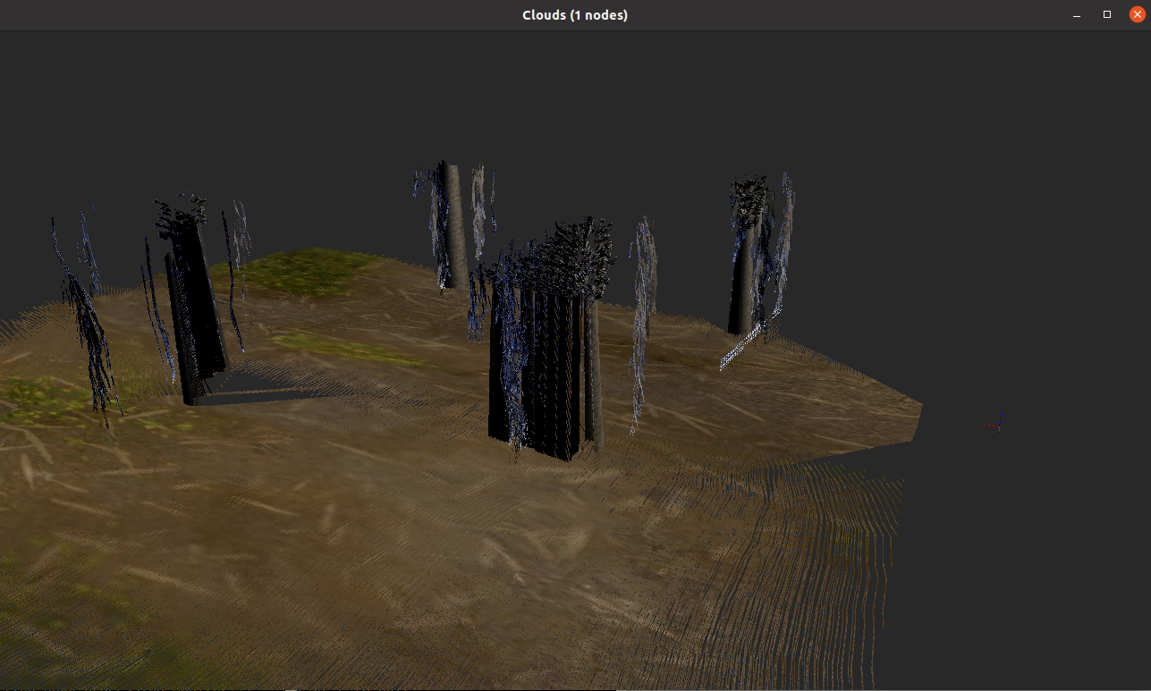
I need to create 3D mapping for outdoor navigation. However, the cloud point produce is not nice and accurate. I am quite new using RTABmap. Hopefully you can help.
|
|
Administrator
|
Is it in a simulator? Can you share a database? The input data look strange.
|
Re: How to have nice cloudpoint of depth sensor?
|
Yes it is. how can I sent the database input data? because Im quite new with ROS.
here is the file for my rtabmap database that i transfer to gdrive : https://drive.google.com/drive/folders/1qBdc1P-57H8a6Dcitw0NrwkSjr5Uxukb?usp=sharing this is the new one since i run it yesterday. I'm using Husky robot, VLP-16, Realsense camera and UST10. Just launching demo_husky.launch file for the testing |
|
Administrator
|
I think the main problem is that the lidar is giving max range data instead of NaN for invalid values, which makes ICP not working correctly:
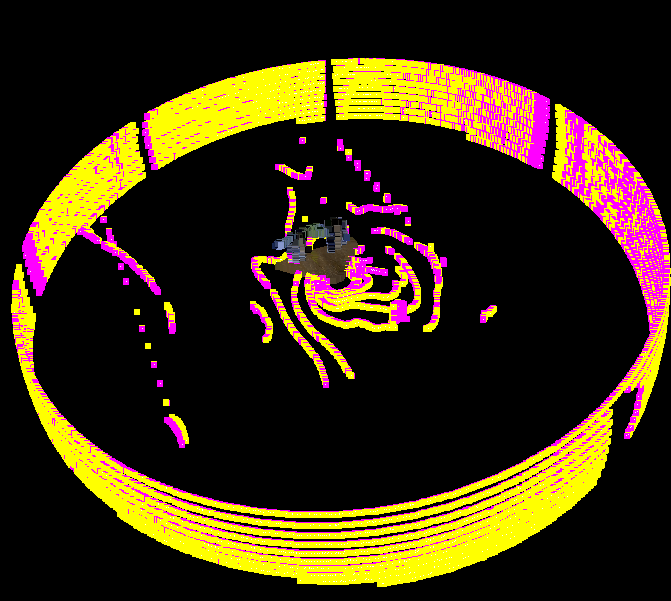 By adding Icp/RangeMax, the resulting point cloud is a lot better: 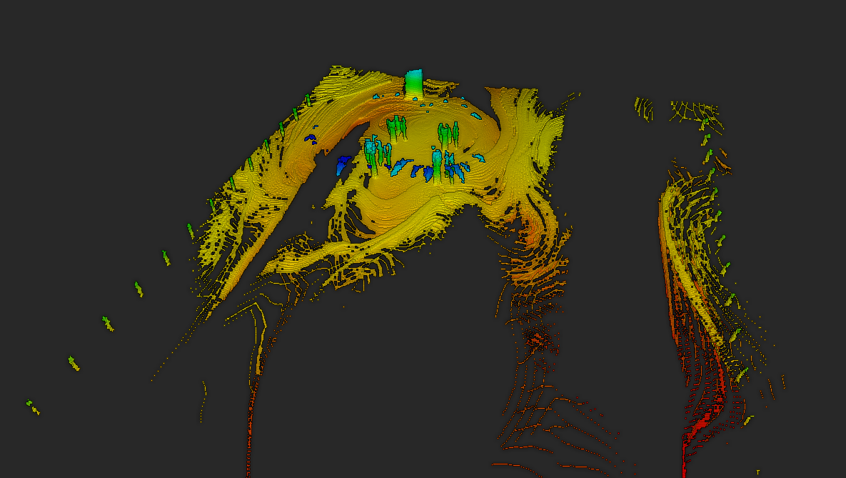 cheers, Mathieu |
Re: How to have nice cloudpoint of depth sensor?
|
May I know what changes I need to do and what is the command you run to get this result.
<?xml version="1.0"?> <launch> <arg name="navigation" default="true"/> <arg name="localization" default="false"/> <arg name="icp_odometry" default="false"/> <arg name="rtabmap_viz" default="false"/> <arg name="camera" default="false"/> <arg name="lidar2d" default="false"/> <arg name="lidar3d" default="false"/> <arg name="lidar3d_ray_tracing" default="true"/> <arg name="slam2d" default="true"/> <arg name="depth_from_lidar" default="false"/> <arg if="$(arg lidar3d)" name="cell_size" default="0.3"/> <arg unless="$(arg lidar3d)" name="cell_size" default="0.05"/> <arg if="$(eval not lidar2d and not lidar3d)" name="lidar_args" default=""/> <arg if="$(arg lidar2d)" name="lidar_args" default=" --Reg/Strategy 1 --RGBD/NeighborLinkRefining true --Grid/CellSize $(arg cell_size) --Icp/PointToPlaneRadius 0 --Odom/ScanKeyFrameThr 0.5 --Icp/MaxTranslation 1"/> <arg if="$(arg lidar3d)" name="lidar_args" default=" --Reg/Strategy 1 --RGBD/NeighborLinkRefining true --ICP/PM true --Icp/PMOutlierRatio 0.7 --Icp/VoxelSize $(arg cell_size) --Icp/MaxCorrespondenceDistance 1 --Icp/PointToPlaneGroundNormalsUp 0.9 --Icp/Iterations 10 --Icp/Epsilon 0.001 --OdomF2M/ScanSubtractRadius $(arg cell_size) --OdomF2M/ScanMaxSize 15000 --Odom/ScanKeyFrameThr 0.5 --Grid/ClusterRadius 1 --Grid/RangeMax 20 --Grid/RayTracing $(arg lidar3d_ray_tracing) --Grid/CellSize $(arg cell_size) --Icp/PointToPlaneRadius 0 --Icp/PointToPlaneNormalK 10 --Icp/MaxTranslation 1"/> <remap from="/rtabmap/grid_map" to="/map"/> <include file="$(find rtabmap_launch)/launch/rtabmap.launch"> <arg if="$(arg localization)" name="args" value="--Reg/Force3DoF $(arg slam2d) $(arg lidar_args)" /> <arg unless="$(arg localization)" name="args" value="--Reg/Force3DoF $(arg slam2d) $(arg lidar_args) -d" /> <arg name="localization" value="$(arg localization)" /> <arg name="visual_odometry" value="true" /> <arg name="approx_sync" value="$(eval camera or not icp_odometry)" /> <arg name="imu_topic" value="/imu/data" /> <arg unless="$(arg icp_odometry)" name="odom_topic" value="/odometry/filtered" /> <arg name="frame_id" value="base_link" /> <arg name="rtabmap_viz" value="$(arg rtabmap_viz)" /> <arg name="gps_topic" value="/navsat/fix"/> <arg name="subscribe_scan" value="$(arg lidar2d)" /> <arg if="$(arg lidar2d)" name="scan_topic" value="/front/scan" /> <arg unless="$(arg lidar2d)" name="scan_topic" value="/scan_not_used" /> <arg name="subscribe_scan_cloud" value="$(arg lidar3d)" /> <arg if="$(arg lidar3d)" name="scan_cloud_topic" value="/velodyne_points" /> <arg unless="$(arg lidar3d)" name="scan_cloud_topic" value="/scan_cloud_not_used" /> <arg name="depth" value="$(eval camera and not depth_from_lidar)" /> <arg name="subscribe_rgb" value="$(eval camera)" /> <arg name="rgbd_sync" value="$(eval camera and not depth_from_lidar)" /> <arg name="rgb_topic" value="/realsense/color/image_raw" /> <arg name="camera_info_topic" value="/realsense/color/camera_info" /> <arg name="depth_topic" value="/realsense/depth/image_rect_raw" /> <arg name="approx_rgbd_sync" value="false" /> <arg name="gen_depth" value="$(arg depth_from_lidar)" /> <arg name="gen_depth_decimation" value="4" /> <arg name="gen_depth_fill_holes_size" value="3" /> <arg name="gen_depth_fill_iterations" value="1" /> <arg name="gen_depth_fill_holes_error" value="0.3" /> <arg if="$(arg icp_odometry)" name="icp_odometry" value="true" /> <arg if="$(arg icp_odometry)" name="odom_guess_frame_id" value="odom" /> <arg if="$(arg icp_odometry)" name="vo_frame_id" value="icp_odom" /> <arg unless="$(arg slam2d)" name="wait_imu_to_init" value="true" /> <arg if="$(arg lidar3d)" name="odom_args" value="--Icp/CorrespondenceRatio 0.01"/> </include> <include if="$(arg navigation)" file="$(find husky_navigation)/launch/move_base.launch" /> </launch> |
|
Administrator
|
In your lidar_args argument, you could add "--Icp/RangeMax 40"
|
Re: How to have nice cloudpoint of depth sensor?
|
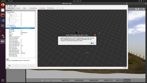
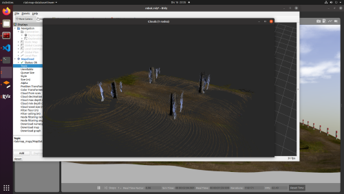
I got it!!! the data seems nice to me. Thank you so much. But I need one more help. I can't download the map into RVIZ. The purpose to run in RVIZ because I want to set Nav Goal. With this question also i want to ask how to implement A* SLAM into it.
|
|
Administrator
|
You will need to use a navigation package that is consuming the map topic from rtabmap. As you are using an husky robot, you may try this demo: https://github.com/introlab/rtabmap_ros/blob/master/rtabmap_demos/launch/demo_husky.launch
|
«
Return to Official RTAB-Map Forum
|
1 view|%1 views
| Free forum by Nabble | Edit this page |

