Login  Register

RTab map vs Open Drone Map?

classic Classic list List threaded Threaded
4 messages Options Options
Embed post
Permalink
Reply | Threaded
Open this post in threaded view
| More
Print post
Permalink

RTab map vs Open Drone Map?

APOS80
Hello there!

I’ve come to master photogrammetry with ODM and I’ve been exploring RTab Map for a while.

On paper I think RTab(iOS) should produce equally good results with less frames because of the extra info collected as in IMU and LiDAR data.

But I have a hard time getting equally good results with RTab.

I would like some feedback/tips on how I can get bette results going forward.

Construction surveyor since 2006 and tech-nerd.

I also use WebODM!
Reply | Threaded
Open this post in threaded view
| More
Print post
Permalink

Re: RTab map vs Open Drone Map?

matlabbe
Administrator
Hi,

They are two different approaches, but for very high quality scans, RTAB-Map won't be able to beat a good scan taken with photogrammetry. In RTAB-Map (as a VSLAM approach), we try to record the less frames possible at lowest resolution (often in motion), which is often not compatible with photogrammetry approaches (requiring high quality images at high resolution, often taken as still pictures other than from a moving video). So we cannot even post-processing data recorded by RTAB-Map into a photogrammetry software, as the results may be worst. For the texturing, the approach included in the mobile app is pretty basic at the moment, so texture may look choppy. We have another better approach but is yet to be integrated in the mobile app:
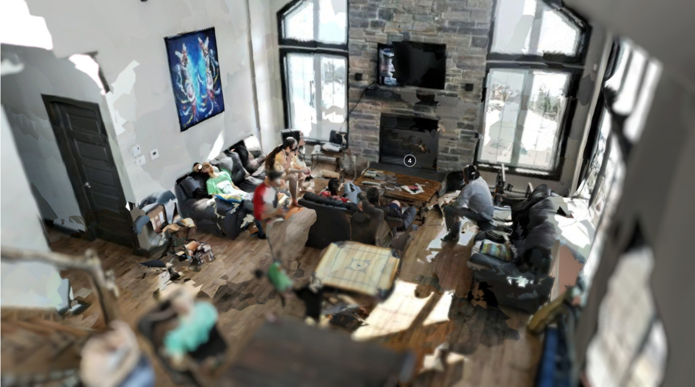
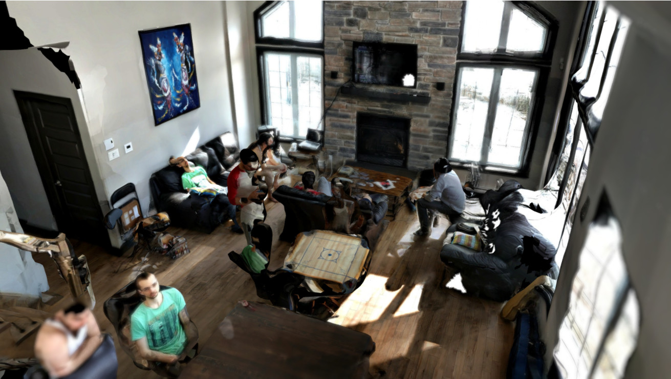
For geometry, it should however be pretty close to reality, under 1-2 cm error.

The LiDAR has its own accuracy and doesn't detect well all surfaces (e.g., black/dark surfaces, also affected by sunlight). However, a perfect textureless white wall may be detected better with the lidar than a camera. Textureless surfaces may appear often curvy with photogrammetry. With LiDAR and VIO, the scale of the model is also inherently known.

For tips, it depends on what you want to scan. But in general, try always to close the loop when scanning a room, that will help to reduce over path error.

cheers,
Mathieu

Reply | Threaded
Open this post in threaded view
| More
Print post
Permalink

Re: RTab map vs Open Drone Map?

APOS80
Thanks!

I’m mostly trying to get a good pointcloud.
Construction surveyor since 2006 and tech-nerd.

I also use WebODM!
Reply | Threaded
Open this post in threaded view
| More
Print post
Permalink

Re: RTab map vs Open Drone Map?

matlabbe
Administrator
With ArKit, we cannot record the real raw LiDAR data, they do some post-processing on it to fill the edges (or even interpolate surfaces without LiDAR returns). That is causing a lot of edge bleeding when looking at the point cloud in RTAB-Map (like at 7:28 in that video). That is maybe one reason why the point cloud may look not super accurate like real LiDAR data.

Not also if the environment is dark, ArKit's VIO can drift more, causing more doubled surfaces. So make sure the environment is well lit.