Save poses in localization
|
Hi Matlabbe,
I'm trying to perform localization in RTAB-Map, but I'm having issues in retrieving poses. Let me first describe a little bit my situation. In two steps: first of all, I create a map database, using recorded images and a source of odometry. Once the map creation is finished, I start a new instance of RTAB-Map, loading in the GUI the database containing the map and a new database without odometry (this second as source). I use data of a similar trip to perform localization. Up to here is fine: the matches between the map and the new database can be seen from the GUI, but I didn't find any way to download the poses (of the localization, not of the whole map). I need them to check the goodness and correctness of localization against ground truth (given by GPS). How should I do to find/record this information? Thank you for your help. |
|
Administrator
|
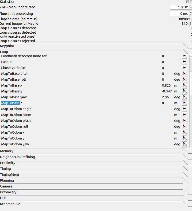
There is a statistic in Statistics panel that give the the current pose of the robot:

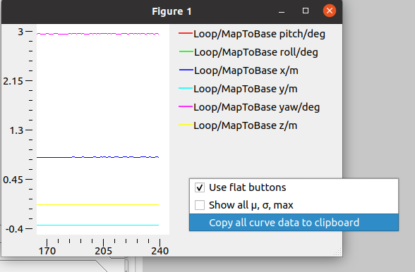
You can plot them (x,y,z,roll,pitch,yaw) in a figure, then in the figure you can copy/paste the resulting data to clipboard so you can have all the poses.  x Loop/MapToBase pitch/deg Loop/MapToBase roll/deg Loop/MapToBase x/m Loop/MapToBase y/m Loop/MapToBase yaw/deg Loop/MapToBase z/m 0.061283 0.000000 0.000000 0.824576 -0.347399 2.956175 0.000000 1.061828 0.000000 0.000000 0.824672 -0.347239 2.958014 0.000000 2.062373 0.000000 0.000000 0.824830 -0.347251 2.952559 0.000000 3.062918 0.000000 0.000000 0.824864 -0.347533 2.957227 0.000000 4.063463 0.000000 0.000000 0.824732 -0.347619 2.951538 0.000000 5.064008 0.000000 0.000000 0.824636 -0.347237 2.956615 0.000000 6.098099 0.000000 0.000000 0.824964 -0.347225 2.958956 0.000000 7.098644 0.000000 0.000000 0.824623 -0.347235 2.962220 0.000000 8.099189 0.000000 0.000000 0.824656 -0.347352 2.951769 0.000000 9.099734 0.000000 0.000000 0.824676 -0.347416 2.952874 0.000000 10.133630 0.000000 0.000000 0.824952 -0.347423 2.958404 0.000000 11.200878 0.000000 0.000000 0.825046 -0.347313 2.958549 0.000000 12.201423 0.000000 0.000000 0.824939 -0.347035 2.959143 0.000000 13.201968 0.000000 0.000000 0.825034 -0.347282 2.959235 0.000000 14.202513 0.000000 0.000000 0.824763 -0.347403 2.954526 0.000000 15.203057 0.000000 0.000000 0.824814 -0.347314 2.958415 0.000000 16.203602 0.000000 0.000000 0.824876 -0.347456 2.958884 0.000000 17.237499 0.000000 0.000000 0.824738 -0.347742 2.955909 0.000000 18.304747 0.000000 0.000000 0.824555 -0.347285 2.947679 0.000000 19.338643 0.000000 0.000000 0.824632 -0.347604 2.957663 0.000000 20.339188 0.000000 0.000000 0.824688 -0.347145 2.957339 0.000000 21.373085 0.000000 0.000000 0.824486 -0.347450 2.956482 0.000000 22.373375 0.000000 0.000000 0.824886 -0.347248 2.957995 0.000000 Other way is to do localization under ROS, so that you could get TF map->base_link each time it re-localizes. |
«
Return to Official RTAB-Map Forum
|
1 view|%1 views
| Free forum by Nabble | Edit this page |

