rtabmap don't recognize the ground and the graph view is full of obstacle
Posted by WhiteLiuu on
URL: http://official-rtab-map-forum.206.s1.nabble.com/rtabmap-don-t-recognize-the-ground-and-the-graph-view-is-full-of-obstacle-tp2090.html
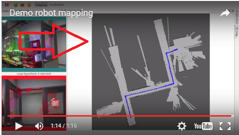
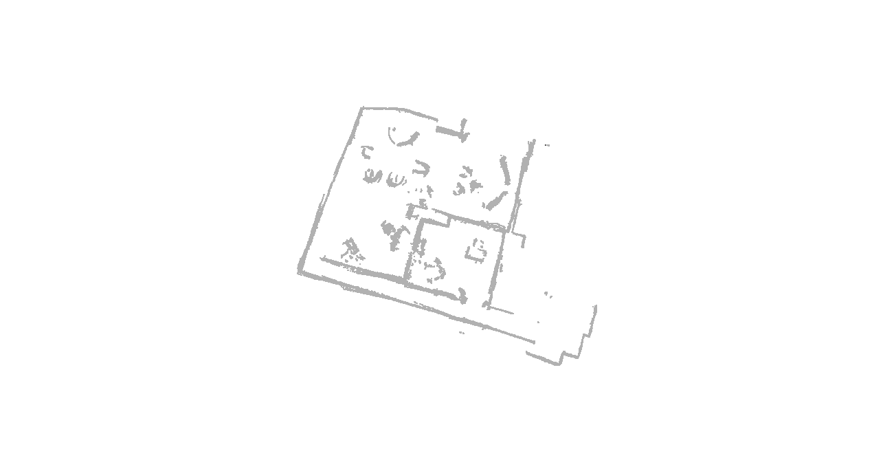
Hi I am using rtabmap with Xtion Openni2 in standalone version 0.11.11.I want to get a 2d occupancy grid map like this,a 2D occupancy grid map.
Question 1:
but this version has no option as "Occupancy from 3D cloud projection on the ground."
I have tried to check the option Force3DoF,Slam2D .The 3D point cloud worked well,but in the graph view,the grid map didn't work well.It seemed like that it could not recognize the ground from other obstacle.
I found and run the demo robot mapping example Yet I couldn't understand what makes that launch file show the 2D grid. I didn't manage to make it work with the openni2. Saving the "RTAB-Map's parameters" from the example to the config.ini file and loading that file didn't worked either.
Question 2:
I tried to use rtabmap_ros or the standalone version with rtabmap,but the latest version is 0.11.8 , it seemed that this version didn't support openni2. The option for openni2 is gray that I could not select or the rtabmap could not show the image.
Question 3:
In the example IROS 2014 Kinect Challenge ,the RTAB-Map setup was base on the "Kinect + Odometry + Fake 2D laser from Kinect" configuration. The "2D laser" was simulated using the Kinect and the depthimage_to_laserscan ros-pkg. In this configuration, the robot is constrained to a plane (x,y and yaw).
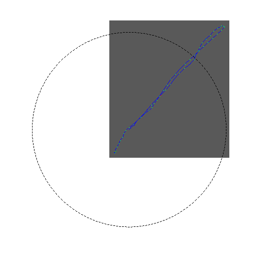
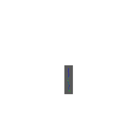
In the file >Export 2D scans , I can get a map scan.ply that looks like a laser scan map.
I also want a map like this. I checked the Source> Laser scans >Generate laser scan from depth image .But I get a .ply file that the point in it was 3D.I read the depthimage_to_laserscan.
In the parameters
~scan_height (int, default: 1 pixel)
The number of pixels rows to use to generate the laserscan. For each column, the scan will return the minimum value for those pixels centered vertically in the image.
So the point was 3D?How I can transfer them to the XY plane?
Hope to get a hint and explanation.
Thank you.
URL: http://official-rtab-map-forum.206.s1.nabble.com/rtabmap-don-t-recognize-the-ground-and-the-graph-view-is-full-of-obstacle-tp2090.html
Hi I am using rtabmap with Xtion Openni2 in standalone version 0.11.11.I want to get a 2d occupancy grid map like this,a 2D occupancy grid map.
Question 1:
but this version has no option as "Occupancy from 3D cloud projection on the ground."
I have tried to check the option Force3DoF,Slam2D .The 3D point cloud worked well,but in the graph view,the grid map didn't work well.It seemed like that it could not recognize the ground from other obstacle.
I found and run the demo robot mapping example Yet I couldn't understand what makes that launch file show the 2D grid. I didn't manage to make it work with the openni2. Saving the "RTAB-Map's parameters" from the example to the config.ini file and loading that file didn't worked either.
Question 2:
I tried to use rtabmap_ros or the standalone version with rtabmap,but the latest version is 0.11.8 , it seemed that this version didn't support openni2. The option for openni2 is gray that I could not select or the rtabmap could not show the image.
Question 3:
In the example IROS 2014 Kinect Challenge ,the RTAB-Map setup was base on the "Kinect + Odometry + Fake 2D laser from Kinect" configuration. The "2D laser" was simulated using the Kinect and the depthimage_to_laserscan ros-pkg. In this configuration, the robot is constrained to a plane (x,y and yaw).
In the file >Export 2D scans , I can get a map scan.ply that looks like a laser scan map.
I also want a map like this. I checked the Source> Laser scans >Generate laser scan from depth image .But I get a .ply file that the point in it was 3D.I read the depthimage_to_laserscan.
In the parameters
~scan_height (int, default: 1 pixel)
The number of pixels rows to use to generate the laserscan. For each column, the scan will return the minimum value for those pixels centered vertically in the image.
So the point was 3D?How I can transfer them to the XY plane?
Hope to get a hint and explanation.
Thank you.
| Free forum by Nabble | Edit this page |