Re: Proj_map min obstacles height
Posted by matlabbe on
URL: http://official-rtab-map-forum.206.s1.nabble.com/Proj-map-min-obstacles-height-tp2866p2918.html
Hi,
Can you try this launch file (change camera topic and attached nodelets manager to obstacles_detection if required)?
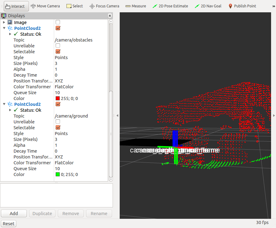
With "Grid/NormalsSegmentation=true" (ground plane segmented):
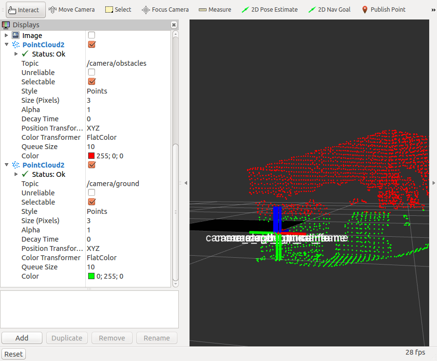
With "Grid/NormalsSegmentation=false" (cloud cut at z=0):
It seems working, maybe there is an other parameter that makes the ground cloud empty.
cheers,
Mathieu
URL: http://official-rtab-map-forum.206.s1.nabble.com/Proj-map-min-obstacles-height-tp2866p2918.html
Hi,
Can you try this launch file (change camera topic and attached nodelets manager to obstacles_detection if required)?
<launch>

<!-- Camera -->
<include file="$(find freenect_launch)/launch/freenect.launch">
    <arg name="depth_registration" value="True" />
</include>

<group ns="camera">

  <!-- Run a VoxelGrid filter to clean NaNs and downsample the data -->
  <node pkg="nodelet" type="nodelet" name="voxel_grid" args="load pcl/VoxelGrid camera_nodelet_manager" output="screen">
    <remap from="~input" to="/camera/depth_registered/points" />
    <remap from="~output" to="/camera/depth_registered/points_downsampled" />
    <rosparam>
      filter_field_name: z
      filter_limit_min: 0.01
      filter_limit_max: 10
      filter_limit_negative: False
      leaf_size: 0.01
    </rosparam>
  </node>

  <node pkg="nodelet" type="nodelet" name="obstacles_detection" args="load rtabmap_ros/obstacles_detection camera_nodelet_manager" output="screen">
      <remap from="cloud"     to="/camera/depth_registered/points_downsampled"/>

      <param name="frame_id" type="string" value="camera_link"/>
      <param name="Grid/NormalsSegmentation" type="string" value="true"/>
   </node>
</group>

</launch>
With "Grid/NormalsSegmentation=true" (ground plane segmented):
With "Grid/NormalsSegmentation=false" (cloud cut at z=0):
It seems working, maybe there is an other parameter that makes the ground cloud empty.
cheers,
Mathieu
| Free forum by Nabble | Edit this page |