rtabmap_ros outdoor 3D mapping
Posted by acp on
URL: http://official-rtab-map-forum.206.s1.nabble.com/rtabmap-ros-outdoor-3D-mapping-tp6104.html
Dear people.
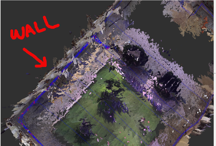
I do have a ZED camera and a Jetson TX2 mounted on a drone. I have taken the drone with my hands to map an outdoor place by means of the rtabmap_ros node.
I do have some problems when I map the outdoor place. I have taken two pictures of the RVIZ pointcloud.
In the picture we can see that the individual pointclouds of the wall do not aligned with the wall.
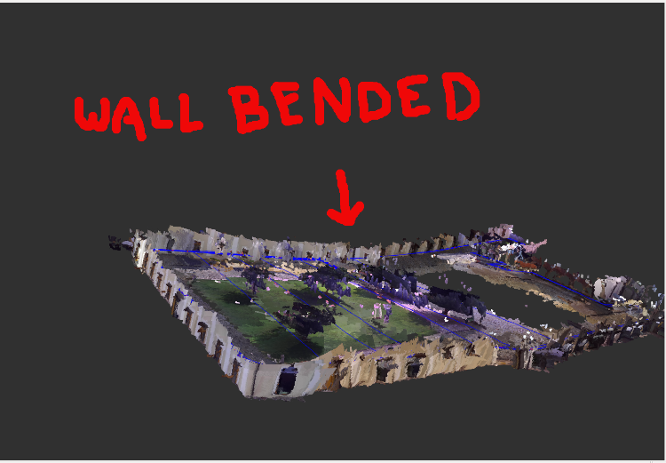
In the next picture the wall is bended.
Do you have any clue how to solve the previous issues.
I am looking forward
URL: http://official-rtab-map-forum.206.s1.nabble.com/rtabmap-ros-outdoor-3D-mapping-tp6104.html
Dear people.
I do have a ZED camera and a Jetson TX2 mounted on a drone. I have taken the drone with my hands to map an outdoor place by means of the rtabmap_ros node.
I do have some problems when I map the outdoor place. I have taken two pictures of the RVIZ pointcloud.
In the picture we can see that the individual pointclouds of the wall do not aligned with the wall.
In the next picture the wall is bended.
Do you have any clue how to solve the previous issues.
I am looking forward
| Free forum by Nabble | Edit this page |