Re: Using Kinect2 and LiDAR to Map and Navigate
Posted by jingyu on
URL: http://official-rtab-map-forum.206.s1.nabble.com/Using-Kinect2-and-LiDAR-to-Map-and-Navigate-tp6599p6621.html
Hi Matlabbe,
I think I solved the plan problem. What you suggest is exactly true, and I follow the tutorial of SetupOnYourRobot (change the parameters as recommended). The result is good! Thanks a lot!
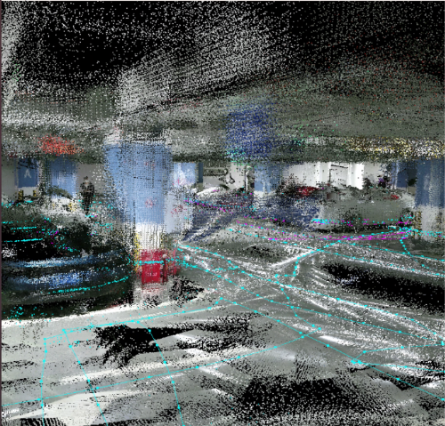
Another question I have is that how to obtain a good top view of the 3D point cloud map. The experimental site is an underground parking lot about 600m2. When I use rtabmapviz to view the database, I found there are many tiny metrices on the top. I think they are the captured roofs of the parking lot. May I have your help on explaining what are these metrices and how to obtain a better top-view picture of the 3D map.
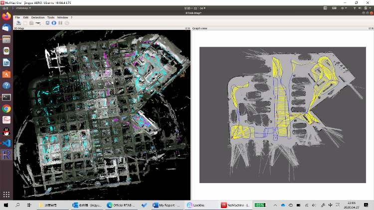
I think it would be better if we can directly see the different vehicles from the top-view side.
URL: http://official-rtab-map-forum.206.s1.nabble.com/Using-Kinect2-and-LiDAR-to-Map-and-Navigate-tp6599p6621.html
Hi Matlabbe,
I think I solved the plan problem. What you suggest is exactly true, and I follow the tutorial of SetupOnYourRobot (change the parameters as recommended). The result is good! Thanks a lot!
Another question I have is that how to obtain a good top view of the 3D point cloud map. The experimental site is an underground parking lot about 600m2. When I use rtabmapviz to view the database, I found there are many tiny metrices on the top. I think they are the captured roofs of the parking lot. May I have your help on explaining what are these metrices and how to obtain a better top-view picture of the 3D map.
I think it would be better if we can directly see the different vehicles from the top-view side.
| Free forum by Nabble | Edit this page |